
Wasatch Front Regional Council, Project-Level Accessibility Metric Calculation
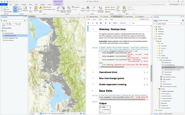
Drawing on High Street’s experience implementing multimodal performance measures, High Street created for the Wasatch Front Regional Council (WFRC) a GIS-based analytical tool that allows the agency and its planning partners to calculate changes in regional accessibility for individual candidate transportation investments. Accessibility is quantified in terms of Access to Opportunity (ATO) which measures how well residents can access jobs, or how well employers can access the labor force. The solution leverages Esri ArcGIS’s Network Analyst to sum the distance-discounted number of households and jobs reachable within a defined travelshed. Projects are simulated via changes to the underlying network and assumptions on impedance values. ATO impacts are estimated for roadway, transit, active.