
New Mexico DOT, Resilience Explorer Application
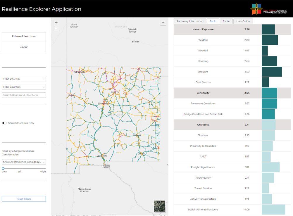
The Resilience Explorer Application is a web-based, Esri application that allows planners, engineers, and researchers in New Mexico to explore their network through a resilience lens. The Resilience Explorer Layer (Resilience Layer) is the primary spatial data source for the Resilience Explorer Application. The Resilience Layer was segmented at logical breakpoints, and resilience metrics were scored for each segment. An overall risk value was then generated for each segment. The Resilience Explorer Application allows users to filter the Resilience Network using components within the application’s UI. Upon filtering the Resilience Network, the web map, tables, and charts automatically update and re-render within the application. Users can analyze an individual network segment, the entirety of the network, or a user-selected subsection.