
Maricopa Association of Governments, StoryMap of Capital Plan Regional Benefits
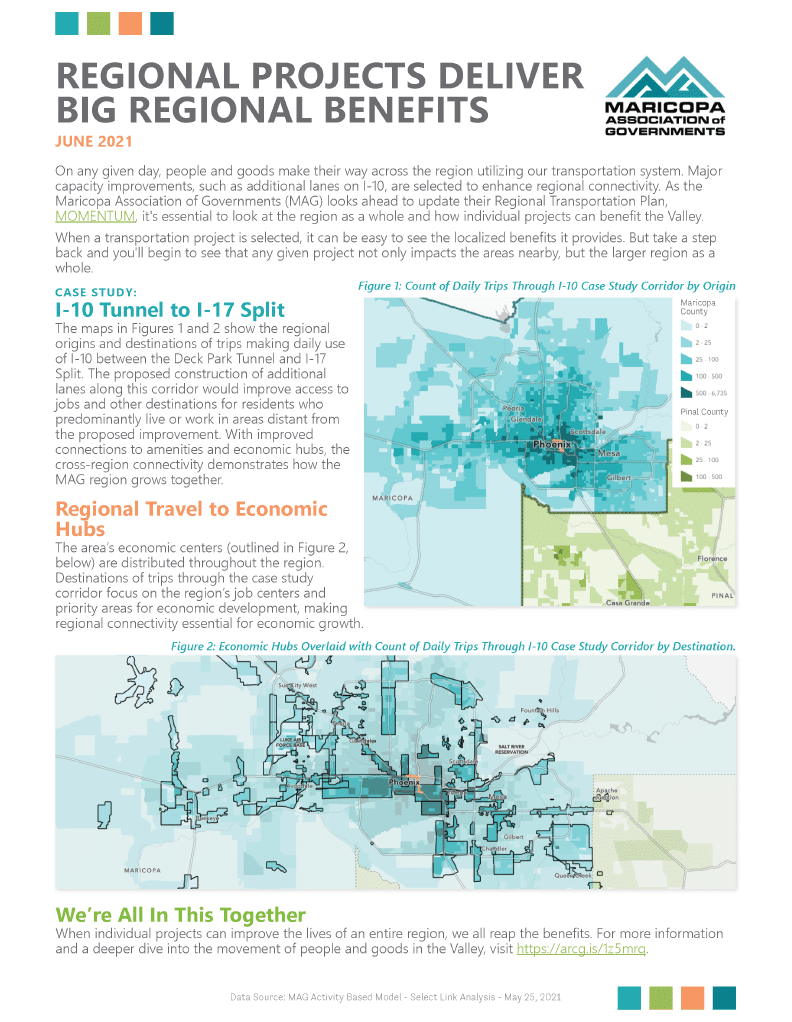
High Street developed an Esri StoryMap to support the Maricopa Association of Governments with communicating their investment decisions for major mobility projects. The StoryMap uses data from a select link analysis, visualizing origin and destination data for all daily traffic going through a sample project location in the downtown area (the I-10 deck park tunnel). The visuals, which include interactive maps and an animated map, demonstrate how the larger metro region relies on access through the tunnel, and such major capacity improvements are selected to enhance regional connectivity. The animated map is particularly helpful in showing the wide geographic spread of trips by volume and by hour of day. The StoryMap was partnered with a one page summary sheet which was provided to stakeholders.